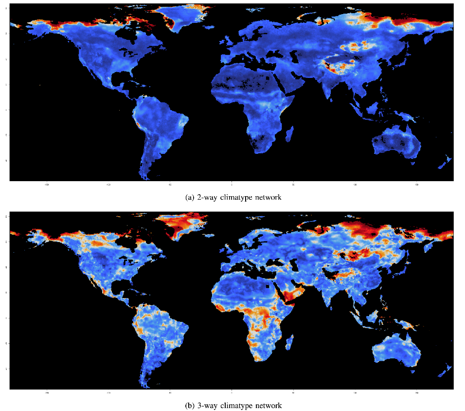
To identify areas around the globe undergoing rapid environmental change, Correlation of Correlations (Cor-Cor), a novel strategy to measure changes in each geolocation’s relationship to all other locations, is applied to series’ of 10-year climatype networks where each network contains approximately 150,000 coordinates. Cor-Cor is applied to the series of 2-way climatype networks in (a) and 3-way climatype networks in (b). This longitudinal analysis allows scientists to track shifts in complex environmental relationships at global scale to identify which areas on Earth are experiencing the most rapid changes. These analyses have important implications on sustainable agriculture (food and bioenergy) and zoonotic spillover events that can lead to pandemics and thus multiple impacts on human health and well-being. Blue color indicates little-to-no environmental change while red indicates large changes. In particular, the series of climatype networks resulting from 3-way vector comparisons highlight significantly more environmental changes compared to 2-way, thereby enabling deeper scientific analysis.
 2-way climatype networks
 3-way climatype networks