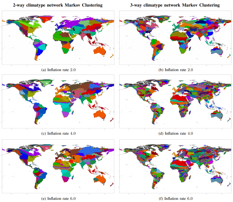
To identify high-resolution climate zones, Markov Clustering (MCL), an unsupervised graph clustering algorithm, is applied to agglomerative 60-year climatype networks with more than 500,000 coordinates around the globe. Since nodes in a climatype network represent geolocations and edges represent environmental similarity, the clusters derived from MCL highlight areas around the globe that share similar climatic features. MCL is applied to climatype networks that result from 2-way vector comparisons in (a, c, e) and 3-way vector comparisons in (b, d, f). Inflation rate, a hyperparameter of the MCL algorithm, is used to control the granularity of the resulting climatype clusters, and is given in the subcaption below each subfigure. Differences in cluster granularity can be seen from increasing the inflation rate and also by comparing 2-way and 3-way network clusters. In particular, climatype networks resulting from 3-way vector comparisons produce significantly more granular clusters, thereby enabling deeper scientific analysis.